Access Hound
-
Training & Services
Training
- Get Quickly Upskilled in Fundamentals In Just Four Hours, We Can Cover the Basics This lively and hands-on session includes foundations, best practices, and writing and online tool practice.
- Audio Description Workshops Invest in Impactful Educational Opportunities We offer half-day intensives, multiple-day workshops, and hackathon-style events. We provide all of the software.
- Team Build, Through an AD Adventure Develop, Complete, and Publish an AD Project Pick a project, like a brochure, that you want audio described, and we'll work on it with you from start to finish.
- Descriptathon, a Gamified Hackathon Team-Based, Impactful, Exciting, and Fun A lively online tournament, friendly competition, your team, facing the questions: Who described it better. And why?
Services
- AD Production and Review Work Directly with People Who are Blind, Low-Vision Our production and review services ensure your AD passes the test for people who cannot see or cannot see well.
- Call in the Experts for Strategic Planning Get an Outsider Perspective, with Insider Knowledge We collect empirical data, analyze it, and help to fix access issues from UX/UI problems to Complete Trip breakdowns.
- Hire Reviewers for Immediate Feedback Our Talented Team Has Deep Lived Experiences Access Hound reviewers provide diverse perspectives, in terms of age, gender, race/ethnicity, and visual-acuity levels.
- Web & Mobile Accessibility Remediation We Take Care of the Maintenance and Upkeep As web accessibility laws and WCAG standards grow more complex, our experts audit, remediate, and future-proof.
Not sure what you need yet? Tell us what you’re building and we’ll point you to the right mix of training, services, and software.
Contact Us -
Use Our Software
AccessHound Guidedogs
- Describe NOW With The Guidedogs Need Image Descriptions Fast? Call The 'Dogs! The 'Dogs give AD writers immediate coaching, support, and guidance as powered by a tailor-made GenAI algorithm.
- Audio Description Plugins & API Use Access Hound Software, Plugins, APIs Our custom-built Plugins, APIs, and White Label software solutions allow you to describe images, across teams, at scale.
Want a demo or help with next steps?
Contact Us -
About Us
Why Work With Access Hound?
- In the News (Hot Off the Presses!) Our thought-leadership columns, written about accessibility, inclusive design, and barriers people face.
- Our Approach and Commitments to You We are people who you can trust to help make your place more accessible and inclusive. Here are ways we earn your trust.
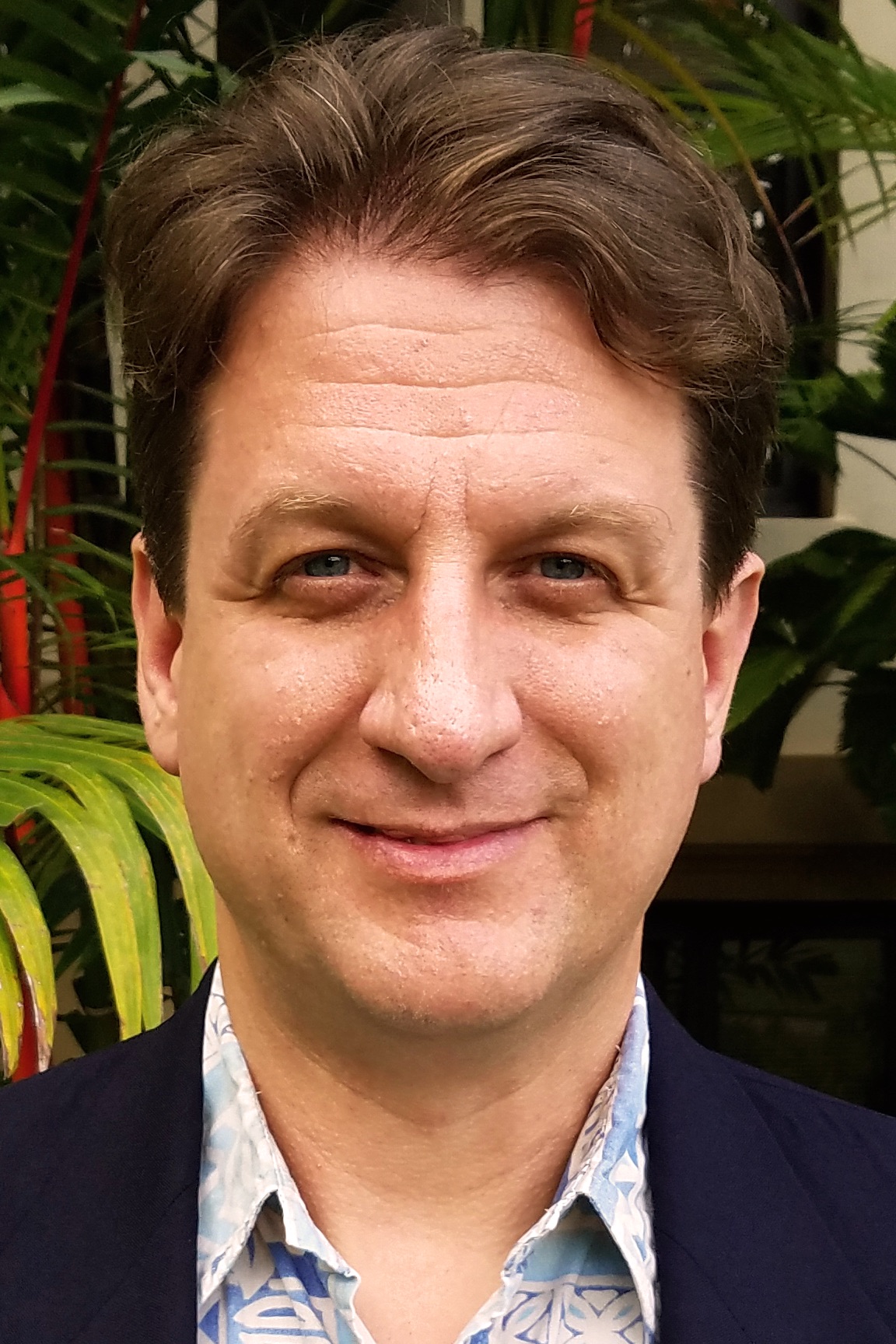
- Who is on the Access Hound team? Our core leadership team has collaborated for more than 20 years, providing diverse, grounded, and high-level expertise.
- Our GenAI-Amazing Guidedogs The Access Hound Guidedogs are AI-powered writing coaches designed to help you to create stronger Audio Description.
- Lived AD Experience? Join Our Pack Access Hound works on projects in every U.S. state, and around the world, and we pay reviewers with lived experience.
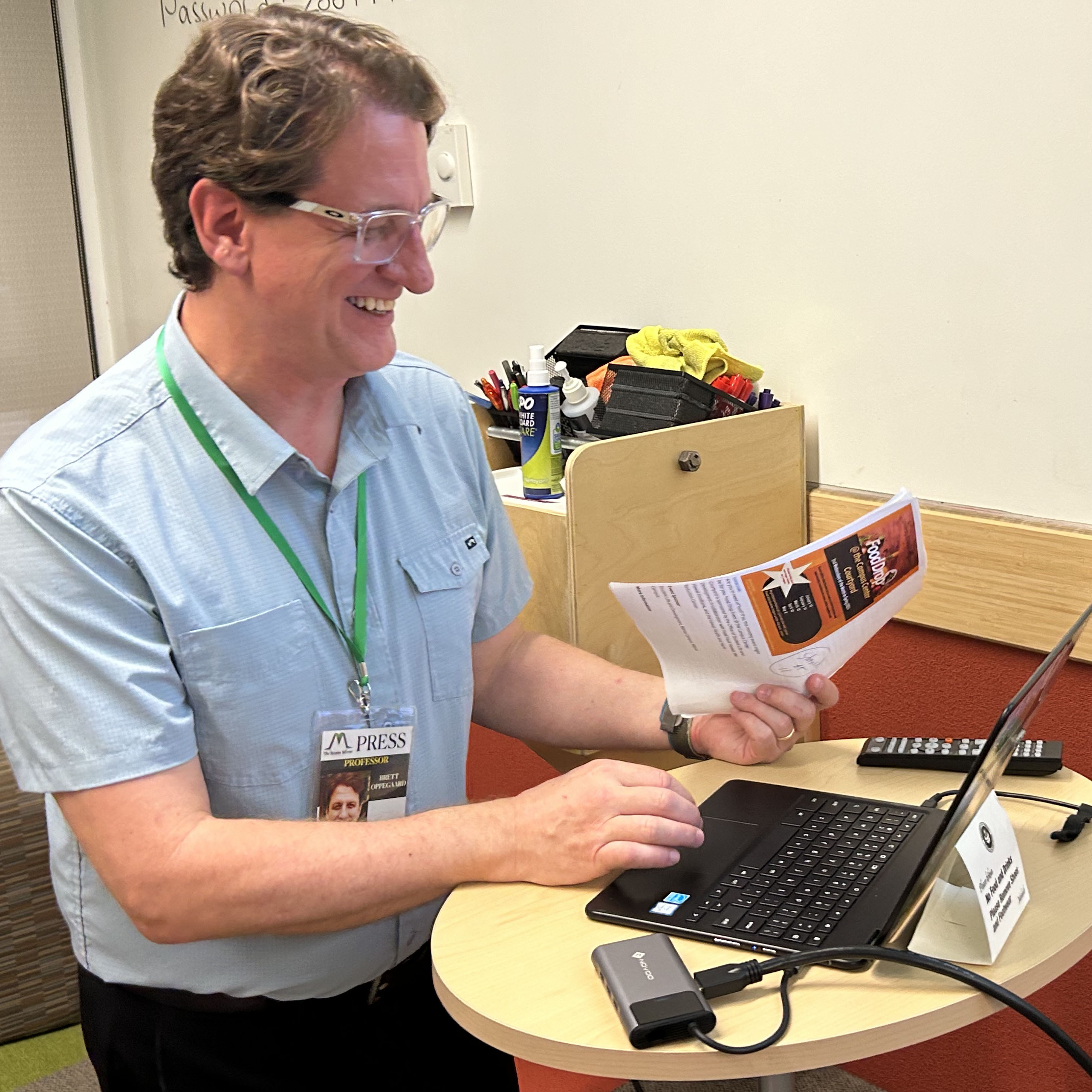
As a part of our accountability to you, Access Houndʻs Founder and Executive Director, Dr. Brett Oppegaard, who started researching Audio Description in 2014, via The UniDescription Project, is open and available to talk with anyone about what Access Hound does and how it does it.
If you have questions, curiosities, or concerns, please contact Dr. Oppegaard at (971) 258-1089 or [email protected]. Thank you for your interest!
Have a quick question, partnership idea, or media inquiry? We’re easy to reach.
Contact Us